Loktak Lake
Appearance
| Loktak Lake (Meitei: Loktāk Pāt) | |
|---|---|
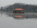
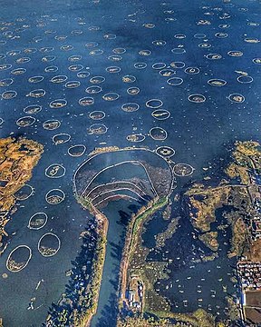
Different views of the Loktak Lake of Manipur | |
| Location | Manipur |
| Coordinates | 24°33′N 93°47′E / 24.550°N 93.783°E |
| Type | Fresh water (lentic) |
| Primary inflows | Manipur River and many small rivulets |
| Primary outflows | Through barrage for hydropower generation, irrigation, and water supply |
| Catchment area | 980 km2 (380 sq mi) |
| Basin countries | India |
| Max. length | 35 km (22 mi) |
| Max. width | 13 km (8 mi) |
| Surface area | 287 km2 (111 sq mi) |
| Average depth | 2.7 m (8.9 ft) |
| Max. depth | 4.6 m (15.1 ft) |
| Surface elevation | 768.5 m (2,521 ft) |
| Islands | Thanga, Ithing, Sendra islands. Also many floating islands called phumdis or phumshongs |
| Settlements | Imphal & Moirang |
| Designated | 23 March 1990 |
| Reference no. | 463[1] |


Loktak Lake (Meitei: Loktak Paat) is the largest freshwater lake in India, located in the central plains of the state of Manipur.[2][3] It is famous for the phumdis (or floating islands) that float on it, of which the largest forms the Keibul Lamjao National Park, the only floating national park in the world.[4][5][6] It is also known as the "world's only floating lake" and is a tourist attraction in Northeast India.
Related pages
[change | change source]References
[change | change source]- ↑ "Loktak Lake". Ramsar Sites Information Service. Retrieved 25 April 2018.
- ↑ "Loktak: the world's only floating lake". indiatimes.com.
- ↑ "Manipur's floating lake at risk". www.indiawaterportal.org.
- ↑ "The world's only floating national park". www.bbc.com.
- ↑ Prakash, Rao; Yogesh, Patil (2016-11-04). Reconsidering the Impact of Climate Change on Global Water Supply, Use, and Management. IGI Global. ISBN 978-1-5225-1047-5.
- ↑ Josh, Jagran. Current Affairs August 2016 eBook. Jagran Josh.


